The Brazilian agribusiness scenario has undergone profound transformations in recent decades, driven by technological advances, environmental demands and, mainly, by the need to guarantee legal security in land ownership and use. In this context, the georeferencing of rural properties has ceased to be a mere formality and has become an indispensable requirement for land regularization.
In 2001, Law No. 10,267, known as the Georeferencing Law, was enacted and later instituted by Decree No. 4,449/2002, with some amendments due to Decrees No. 5,570/05, 7,620/11 and 9,311/18. Georeferencing has become an essential tool for ensuring accuracy in the delimitation of rural properties, ensuring the authenticity of information before public agencies and, consequently, adding value to the property. More than a legal obligation, it is an investment that brings concrete benefits to rural producers, real estate professionals and investors.
In this article, you will understand what georeferencing is, how the process works, what the current legal requirements are and how it contributes to the appreciation and security of rural properties.
Georeferencing rural properties is a fundamental technical process for the precise delimitation of the boundaries of a property.
This involves obtaining exact geographic coordinates, which allow the location and extent of a rural property to be unequivocally identified. Through analyses and surveys carried out using advanced technology and specific engineering knowledge, this procedure guarantees positional security, legal certainty, transparency in the acquisition and negotiation of areas, in addition to providing essential data for calculating fees and other applications.
To make it easier to understand, imagine that today you have a polygon with georeferenced coordinates that precisely define the boundaries of your property. This registration prevents a neighbor from invading, even inadvertently, the perimeter that is yours, when regularizing his property in the future, during the analysis carried out by the Real Estate Registry. Georeferencing is, therefore, an instrument that protects property rights and prevents land conflicts.
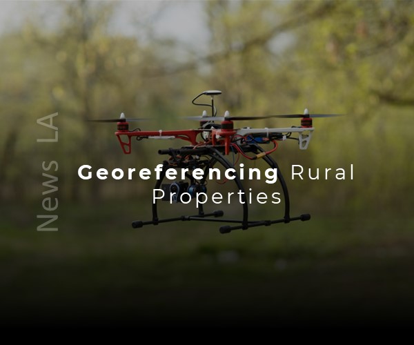
The georeferenced topographic survey process, which is necessary to obtain these coordinates, is not simple. It requires high-tech equipment, such as centimeter-precision GPS, as well as other instruments that vary according to the characteristics of the property’s topography. This technical complexity demands specialized and experienced professionals, capable of taking accurate measurements and interpreting the data carefully. The result of this work today allows the delivery of information in formats that go beyond the traditional: maps with aerial images, 3D models, QRCodes for specific visualization, among other resources that can be used for planning, management and studies of land use and occupation.
For georeferencing to fulfill its role efficiently, it is essential to start the process with a careful analysis of the owner’s needs. Next, the property documentation is gathered and verified, such as the registered deed or transcript, in addition to a dialogue with the owner to understand whether the property is properly fenced and whether there are possible conflicts or inconsistencies with neighboring properties. This initial survey is crucial to ensuring an organized and assertive workflow.
The importance of georeferencing is directly linked to the legal requirements of INCRA, the agency responsible for regulating the certification of georeferenced rural properties. INCRA establishes strict technical standards, ensuring that the service presents high precision and reliability. In addition to defining the vertices and their respective coordinates, the INCRA system requires additional information about the neighboring abutments, the property registration to which they belong, as well as data on the existence of public roads, rivers, among other aspects that may interfere with the delimitation of the property. Each vertex of the property must meet specific precision criteria, as determined by the Technical Manual of Georeferencing.
Decree No. 4,449 of October 30, 2002, regulates the georeferencing of rural properties in Brazil, as established by Law No. 10,267/2001. The decree establishes the rules and procedures for the georeferenced description of the boundaries of rural properties, requiring that this information be expressed by geographic coordinates with technical precision, respecting the Brazilian Geodetic System. The main objective of this regulation is to guarantee legal certainty and precision in the identification of properties, preventing litigation and ensuring correct registration in the real estate registry office. Among the main functions of the decree, the standardization of technical procedures for conducting topographic surveys and the definition of requirements for the survey to be accepted by INCRA and, subsequently, by the registry offices stand out.
Another important aspect addressed by the decree is the staggered deadlines for mandatory certification, which vary according to the size of the property. Currently, at the beginning of 2025, the requirement for certification by INCRA applies to properties with areas between 25 and 100 hectares. From November 2025, the requirement will be extended to properties with less than 25 hectares, which means that all rural properties must be duly certified.
It is important to emphasize that georeferencing is only one step in the land regularization process. Although a qualified surveyor or technician can survey the coordinates of the property, the certification process at INCRA requires the presentation of documents and compliance with strict technical criteria. INCRA’s system checks for possible overlaps with neighboring properties and allows other professionals to analyze the georeferenced data. If any irregularity is found, such as incorrect positioning of the property, there is the possibility of contestation, which reinforces the need for the service to be performed with technical responsibility and a long-term commitment. To this end, INCRA requires that the professionals responsible be accredited, which implies hours of study and updating focused specifically on the georeferencing service.
The benefits of georeferencing are significant. A regularized and certified rural property offers greater liquidity in negotiations, increases asset value, facilitates access to credit lines, and enables participation in government programs. On the other hand, the lack of regularization can result in obstacles to property transfers, lengthy bureaucracy in inheritance processes, mandatory consent from neighbors for certain actions, in addition to the risk of litigation and the impossibility of carrying out divisions, unifications, or financing.
Given the complexity and importance of the process, it is recommended to seek specialized companies and experienced professionals to conduct georeferencing efficiently, ensuring that potential problems are prevented or resolved quickly. One point to note is that, unfortunately, there are professionals who perform the service but, years later, when pending issues arise, they become difficult to locate, making it time-consuming to resolve any problems. Therefore, having a consolidated and committed team like LA Arquitetura e Engenharia over time is essential to ensure peace of mind and legal security for the rural property owner.
Hugs and see you soon!
Suelem Ribeiro
Recent Comments